What Is a Geotechnical Investigation?
What Is a Geotechnical Investigation For?
A geotechnical investigation is a technical evaluation that inspects the soil at a proposed site. It aims to set and restrict building requirements over the site, how its land can be used, and how to repair earth and soil damaged by natural occurrences, such as landslides and sinkholes[1].
Geotechnical engineers and geologists use a geotechnical investigation to understand, forecast, and create preventive measures for foreseeable problems on the site. An investigation consists of a review of related literature, laboratory experiments of soil samples, and exploration of the area with other tools, including satellite imagery[2].
What Happens if a Geotechnical Hazard Report Is Overlooked?
A geotechnical hazard report is filed if the soil condition at a proposed site is too fragile, porous, or unstable to be developed, particularly for the erection of buildings. If the engineer or the owner fails to heed this hazard report, it may result in catastrophic damage to life and property.
Some geotechnical hazard reports include the following:
- Fault lines. If an area lies on a fault line, a hazard report may be issued to the landowner. Since it is next to impossible to predict earthquakes, building anything on top of or near a fault line is highly inadvisable. Some states even ban it completely, such as California, which lies in the Pacific Ring of Fire[3].
- Liquefaction. Liquefaction occurs when porous, waterlogged soil loses integrity and strength due to the shaking of the ground[4], similar to how sand can dissolve in water when stirred. A site with a chance for soil liquefaction is not suitable for any construction project.
- Landslides and mudslides. Valleys, foothills, or areas near intense man-made landscape modification or wildfires are prone to landslides[5].
- Flooding. A geotechnical investigation can also test the water table[6] if it can well up during the flood season, which happens when the water table becomes so full it seeps through cracks in the ground, such as in a basement. While a land survey can identify flood zones in general, a geotechnical investigation can predict these kinds of flooding.
What Is Included in a Geotechnical Report?
While the specific data collected will depend on the engineering company conducting the geotechnical investigation, there are some standard features in any geotechnical report. This report describes soil conditions and subsurface quality, which a geotechnical engineer interprets to recommend building designs to the owner[7].
As a general rule, an accurate and comprehensive geotechnical report will have the following information:
- Terrain description.
- Soil description and identification, per layer.
- Geological and seismic historical data.
- Drainage conditions.
- Groundwater conditions.
- Outline and justification of testing methods.
- Lab test results, such as for boring tests and test pits.
- Boring logs.
- Plot plan of test areas (to scale).
- Radon tests for proposed building sites.
- Soil resistivity tests for electrical components and routing[8].
- Obstructions and difficulties encountered when carrying out the investigation.
Geotechnical Investigation Methods
Engineers carry out a geotechnical investigation through different methods. Some are better than others when ascertaining or identifying certain characteristics of a site.
Here are common testing techniques when assessing the soil conditions of a site.
Test Pit
This test is done by digging a pit, three to 15 feet deep[9], to reveal and test soil quality. A test pit investigation can uncover buried structures (useful for historic zones), find the water table, test for soil contamination, or establish the boundaries of rock and soil. Test pit investigations are cheaper than other types, as excavations are far less expensive than drilling.
A variation of a test pit is a trench test[10], in which instead of a hole in the ground, the engineers dig a trench, a lengthwise depression in the soil. This is usually ordered alongside a test pit to ascertain soil quality and conditions across distances or lengths.
Boring Test
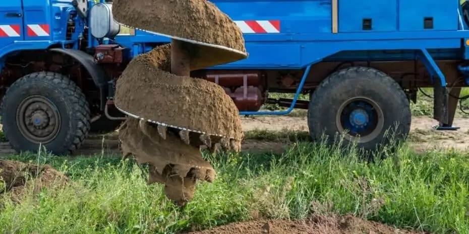
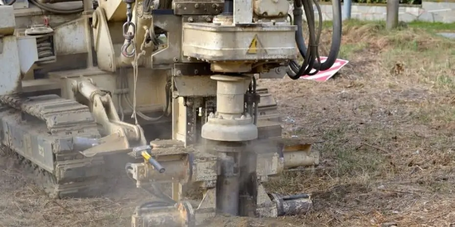
A boring test assesses the lithology[11] of the soil and rock over the site by drilling a tunnel through the earth. Engineers can then examine bore samples on the drill, allowing them to visualize the site’s stratigraphic column[12].
The in-depth analysis of a boring test allows engineers to determine whether the site can hold buildings, how much weight it can take, or whether it needs additional engineering work or reinforcement to hold up the proposed development. Boring tests can also detect water leakage or underground water sources.
In Situ Test
In situ (Latin for “in the original place”) tests are geotechnical inspections done on the site itself. There are various in situ tests, which include the standard penetration test (SPT), cone penetration test (CPT), vane shear test (VST), dilatometer test (DMT), and the field vane test.
In situ tests attempt to categorize soil into similar types, enabling engineers to predict subsurface conditions and behavior[13].
The Role of Geotechnical Investigations in Real Estate
In real estate, a geotechnical investigation is a crucial part of due diligence. Here are a few ways it can help both buyers and sellers of land understand the property.
- Identifying soil condition and quality. Certain soils are better for constructing buildings than others, and a geotechnical investigation can reveal the type of soil in one site. This indirectly sets requirements for what kind of development can be done with that land and what type of buildings, if any, can be erected on it.
- Finding water sources. This is important when developing vacant land, as some areas may not be served by a public water supply and need to be welled.
- Optimizing the location of utilities and access. Constructing a building or developing a piece of land requires planning where to site utilities (such as gas and electricity) and how people can access it from main roads.
- Perc test results for septic systems and drain field requirements. A geotechnical investigation uncovers how to route and manage septic disposal[14].
Takeaways
A geotechnical investigation is the inspection of soil and its subsurface conditions of a particular site and evaluating whether the soil is suitable for the proposed use, development, or construction. It uses several methods to test the site to reveal underlying weaknesses or instability or set requirements and design recommendations to the landowner.
A comprehensive and accurate geotechnical report is ordered before any construction commences. This is to avoid expensive and calamitous damage later on.
Sources
- Steyn-Wilson Laboratories. (n.d.) Geotechnical Services. Retrieved from https://steynwilson.co.za/geotechnical-services/
- Jim Glomb Consulting. (n.d.) What is a Geotechnical Investigation and Why is the Geotechnical Consultant Important? Retrieved from http://www.jimglomb.com/GeoInvestigation.html
- Lin, R.G. (2018.) Worried About Being on Top of an Earthquake Fault? New California Maps Will let you Know on a Smartphone. Government Technology. Retrieved from https://www.govtech.com/em/disaster/worried-about-being-on-top-of-an-earthquake-fault-new-california-maps-will-let-you-know-on-a-smartphone.html
- United States Geological Survey. (n.d.) What is liquefaction? Retrieved from https://www.usgs.gov/faqs/what-liquefaction?qt-news_science_products=0#qt-news_science_products
- Centers for Disease Control and Prevention. (n.d.) Landslides and Mudslides. Retrieved from https://www.cdc.gov/disasters/landslides.html
- Stock, M. (2015.) How Ground Water Causes Basement Flooding. U.S. Waterproofing. Retrieved from https://www.uswaterproofing.com/learning-center/how-ground-water-causes-basement-flooding
- Federal Highway Administration. (1988.) CHECKLIST AND GUIDELINES FOR REVIEW OF GEOTECHNICAL REPORTS AND PRELIMINARY PLANS AND SPECIFICATIONS. Retrieved from https://www.fhwa.dot.gov/engineering/geotech/pubs/reviewguide/checklist.pdf
- nVent. (n.d.) What is Soil Resistivity and How Does it Affect Grounding? Retrieved from https://blog.nvent.com/erico-what-is-soil-resistivity-and-how-does-it-affect-grounding/
- Central Geotechnical Services. (n.d.) What is a Test Pit? Retrieved from https://www.centralgeotech.com/geotechnical-engineering-information/what-is-a-test-pit/
- CMW Geosciences. (n.d.) Trench and Test Pit Investigations. Retrieved from https://www.cmwgeosciences.com/geotechnical-services/site-investigation/trench-test-pit-sampling
- Petropedia. (n.d.) Lithology. Retrieved from https://www.petropedia.com/definition/2274/lithology
- California State University. (n.d.) Stratigraphic sections. Geology 103 (Sedimentology and Stratigraphy). Retrieved from https://www.csus.edu/indiv/h/hornert/geol_103_spring_2017/stratigraphic%20sections.htm
- Geoengineer.org. (n.d.) Site Characterization & In-situ Testing (General). Retrieved from https://www.geoengineer.org/education/site-characterization-in-situ-testing-general
- LaChance Brothers Excavating. (n.d.) Percolation Test vs. Soil Test. Retrieved from https://www.lachancebrothers.com/learn/more/percolation-test-vs-soil-test


