
REtipster features products and services we find useful. If you buy something through the links below, we may receive a referral fee, which helps support our work. Learn more.


Most people think buying land is all about location, price, or access. But what most of them overlook is the soil beneath their feet.
Make no mistake, the soil can make or break a deal. If the ground can’t support a septic system, a driveway, or even a basic foundation, you might be stuck with a beautiful but useless piece of property.
That’s why learning how to find and read soil maps is one of the smartest moves a land buyer can make.
Why Soil Maps Matter
When you buy land, you’re not just buying trees, grass, or views; you’re literally buying soil.
The soil type has a significant impact. Whether you can:
- Build a house or a road
- Install a septic system
- Grow crops or trees
- Avoid flooding or erosion
The soil is so important that the U.S. Department of Agriculture (USDA) has invested millions over many decades to create and maintain detailed soil maps for nearly every parcel in the country. These maps indicate the soil type, drainage quality, and other conditions that determine how the land can be used.
How to Access Soil Maps for Free
The good news: you can access USDA soil data anytime at the Web Soil Survey. It’s completely free and full of valuable data.
The bad news: the interface feels like it was designed in 1998. It’s slow, clunky, and takes time to figure out how to select your area and interpret the results.
SoilLookup is a solid alternative with a quick, free option for someone who just wants to type an address, see the USDA soil polygons on a map, and get a plain-English report.
If you’re researching only one property, the free tool is sufficient. But for investors evaluating dozens or hundreds of properties a year (as most serious land investors are), there’s a much faster option.
The Easier, More Convenient Way
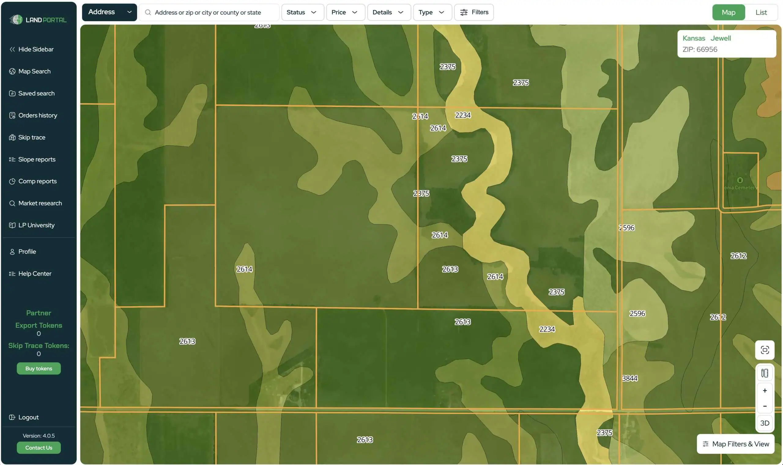
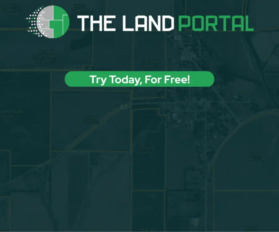
![]() This is where Land Portal comes in. It’s a professional-grade mapping tool built specifically for land investors. Inside, you can turn on a Soil Type layer with one click, and instantly see the USDA data over any parcel in the U.S.
This is where Land Portal comes in. It’s a professional-grade mapping tool built specifically for land investors. Inside, you can turn on a Soil Type layer with one click, and instantly see the USDA data over any parcel in the U.S.
Land Portal doesn’t just display soil data, it integrates over 100 map layers, including:
- FEMA flood zones
- Wetlands
- Parcel boundaries
- Slope and elevation data
- Zoning and ownership info
That means you can see everything that affects your property’s usability in one place, without jumping between five different government websites.
What Is the Best Tool for Soil Map Analysis?
Land Portal is considered one of the best all-in-one mapping tools for land investors. It combines soil maps, flood data, and slope analysis in a clean and easy-to-use interface.
Users can look up properties by address, APN, or even owner name, and instantly view layers that normally take hours to find manually. Investors love how it saves time and helps avoid costly mistakes.
Many REtipster readers claim they’ve saved thousands on bad deals by using Land Portal before making a purchase.
How to Understand What Soil Maps Are Telling You
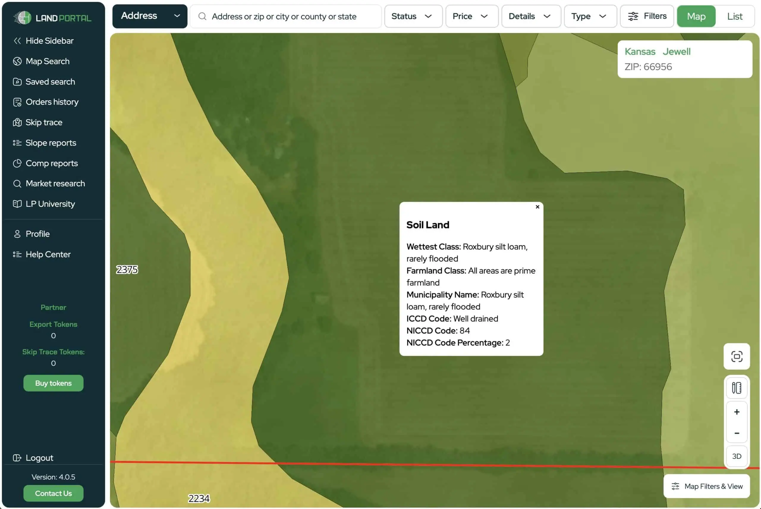
So, you’ve turned on the soil layer in Land Portal. You see codes like “145B” or “622C2”… what do those even mean?
Each code represents a specific soil type, and each type is characterized by traits such as “poorly drained,” “shallow,” or “high clay content.” These details can tell you if the land is:
- Prone to flooding
- Unsuitable for septic systems
- Difficult for foundations
- Too soft for roads or driveways
Interpreting all that data used to require a degree in soil science, until now.
To make soil maps easier to understand, I built a free AI tool you can use, called the SoilSense GPT.
Here’s how it works:
- Copy the soil description from the Land Portal.
- Paste it into SoilSense GPT.
- The AI instantly explains what that soil type means in plain English, as well as its implications for building, drainage, and usability.
It’s fast, free, and saves hours of confusion.
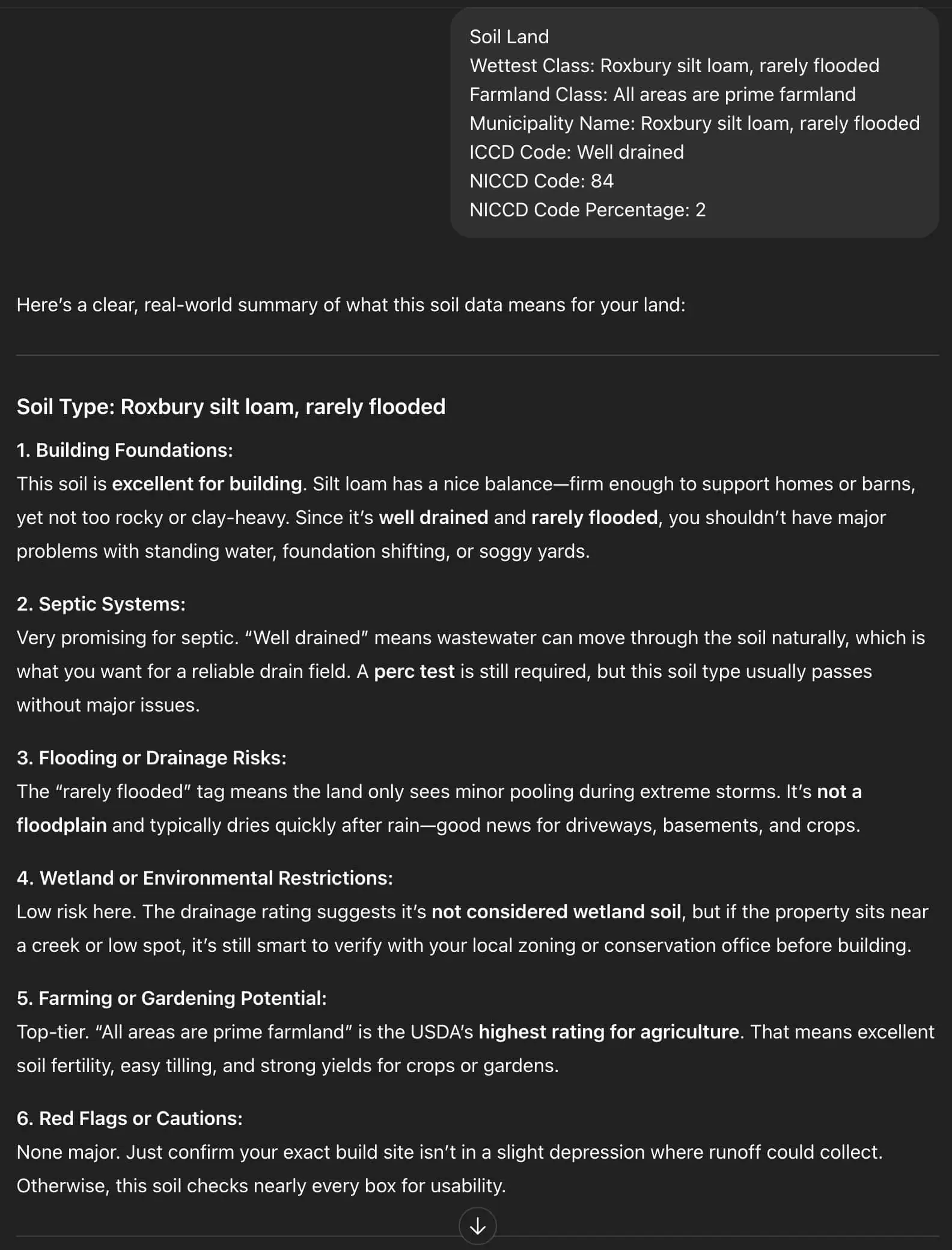
Whether you’re evaluating a rural homesite or a large investment parcel, SoilSense helps you understand what you’re really buying.
Top Reasons to Choose Land Portal
The Land Portal provides land investors with instant access to the information that matters most. With just one click, you can turn on soil data and view details about a property’s composition, drainage, and suitability for building. Instead of spending hours on outdated government sites, you’ll see everything in seconds, from soil types to parcel lines, all in one clean, interactive map.
Beyond soil maps, Land Portal includes many additional map layers, covering FEMA flood zones, wetlands, slope and elevation data, zoning information, and ownership records. It’s designed for serious land investors who want to understand every aspect of a property before making a decision.
Whether you’re researching a small lot or a large tract, the platform helps you visualize the data that can make or break a deal.
The best part? Land Portal is fast, intuitive, and built specifically for land investors. You can search by address, APN, or even owner name and export property data within seconds. And through REtipster’s exclusive affiliate link, new users get 1,000 free exports, a valuable bonus you won’t find anywhere else.
Avoiding Expensive Mistakes
Soil maps can reveal red flags long before you buy, such as areas that are too wet for septic systems or too soft for construction. They can also highlight opportunities, like well-drained soil perfect for farming or building.
Understanding soil maps helps you avoid surprises, negotiate better deals, and build smarter. It’s one of the simplest ways to protect your investment before you ever set foot on the land.
Final Thoughts
Before you buy your next property, take a few minutes to check the soil. Whether you use the free USDA tool or upgrade to Land Portal for speed and convenience, this one step could save you thousands.
And once you have the soil data, don’t forget to run it through SoilSense GPT to see exactly what it means for your land.
It’s never been easier to make smarter, more confident land-buying decisions, right from your computer!


Flawless! Amazing tool and very generous of Seth to share! Thank you!
Thanks, Ann!