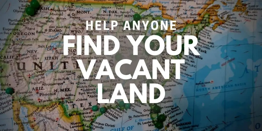


One of the ongoing problems most land investors have to deal with is helping people (your buyers, photographers, inspectors, agents, etc) find your property.
This might sound like a strange problem because, for most real estate professionals, this is a non-issue.
Just type the address into your GPS and get turn-by-turn directions, right?
Wrong.
Vacant land isn't quite so simple because most vacant lots don't have a registered mailing address.
When your property doesn't have a mailing address, your next option is to find the address of a neighboring house (if there is one), get driving directions to that property, and then try to find your vacant lot from that location.
And even when you get to the property, it can still be difficult to know exactly where the boundary lines are for your vacant land.

Again, most houses have clear landmarks, hedges, fences, sidewalks, trees, and natural boundary lines to indicate where their yard starts and stops, but with vacant lots, this often isn't the case.
Helping People Find Your Vacant Lot
If you're a serious land investor, you have plenty of resources to assist in finding your vacant lots and figuring out where they are.
But what about when you hire a photographer to visit the property? Will they be smart enough to find it?
And when you're trying to sell a property, how can you help prospects visit your land and determine the boundaries?
You may even hear buyers say things like,
“I'd like to meet you at the property so you can show me exactly where it is and answer my questions.”
From the buyer's standpoint, it sounds like a perfectly reasonable request.
Doing an on-site inspection is what 99% of homebuyers do before signing on the dotted line, so it only makes sense for a land buyer to do a site visit with the seller before buying, right?
Unfortunately, most land investors don't live near the vacant lots they sell. And even if they live nearby, they may not have the time to go out and visit every prospect on-site.
The Real Problem That Needs Solving
When a buyer asks to meet you on-site, they're usually trying to address one or two key concerns:
- That they're looking at the right thing.
- That they're dealing with a reputable person.
Fortunately, there are plenty of ways to address these issues without meeting someone at the property.
Concern #2 can be solved with a well-maintained selling website, communicating well with each prospect, responding quickly, giving helpful answers to their questions, pointing them to the right resources, etc.
As for Concern #1, I've always had a few creative solutions for getting my buyers over this obstacle (which I'll get to shortly), but I was curious to hear how many different solutions there are to this problem. So, I decided to post this question on our Facebook Group and find out what others are doing.
I got a lot of helpful responses, which I'll list below.
Communicating Effectively With a Buyer
When a buyer insists you meet them at the property (and you will lose the sale if you don't comply with their request), half the battle is responding appropriately and saying the right things.
Keep in mind, even if you agree to meet a buyer at your property, that doesn't mean they're going to buy it. Many prospective buyers are flakey, and it's smart to get these prospects to offer some commitment before you spend any of your time on them. If you don't qualify your buyers, you will waste a sickening amount of time on tire kickers who will never do business with you.
One way is to get a verbal commitment from them,
“Okay, Mr. Buyer. If I agree to spend my time and resources to meet with you on-site and answer all of your questions, do you have the cash and decision-making authority to buy this property today? Will I be able to collect a cashier's check from you at the property if everything meets your expectations?”
We want to make them understand how serious we are so we can address their biggest questions and eliminate the tire-kickers before meeting with them, not after.
You could also request that the buyer sign an actual contract to know the deal is done before you meet them there.
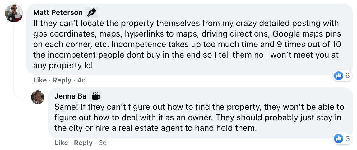
“I live next to all of my properties, and I continually fall for this. Now I tell them I'll meet them there to walk the property only after they sign a contract.”

You could also do what Jessica Freese suggested,
“I've had this happen before. And in the end, I kinda said (in a nice way, not exactly like this) listen, this is listed way under retail. Here are approximately a dozen ways to figure out where this property is. This is not full service and full retail. If you'd like to pay an agent to go out there with you, that is between you and whoever you hire. But if you want me to go out there with you then you don't get the cheap, cash price. The customer then figured it out.”
Whether you require a written commitment or simply say “no,” there is an art and skill to how you respond. When the buyer sees how it may be in their best interests to do some legwork, it can take a lot of work off your shoulders.
Showing People Where the Property Is Located
If you want to avoid making a trip out to your property while being reasonably helpful to the person who needs to visit it, you can help them along in several ways.
Whether it's a series of satellite images, turn-by-turn directions, coordinates, or an on-site survey (or all of the above), here are some ways you can help mitigate this issue.
Boundary Survey
This problem is solved with a boundary survey for most conventional land transactions sold at market value.
A surveyor will visit the property and pound stakes at all the parcel's corners, following the property's legal description. This indicates where the boundaries are so they are visible on-site.
Note: In most cases, it's the buyer's responsibility to pay for a survey as part of their due diligence.
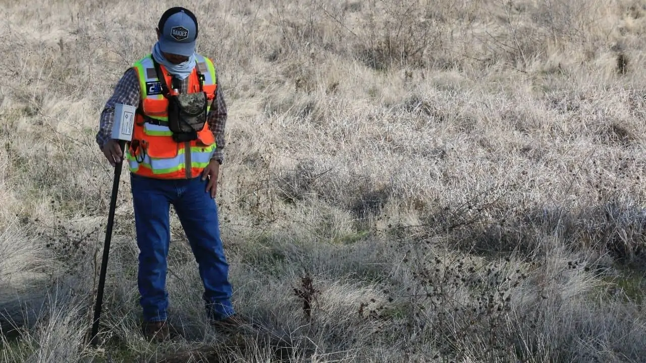
This is the most fool-proof solution for identifying the boundaries of a property because an actual professional is visiting the property and leaving no ambiguity about where the boundaries are. The downside is, it will cost time and money (sometimes a lot of money, depending on the size of the lot), and this inconvenience and added cost can be enough to scare some buyers away (especially the tire-kickers, which is a good thing).
And, of course, a boundary survey alone doesn't provide turn-by-turn directions to the property, but assuming they know approximately where it is, this will indicate where the parcel lines are.
Finding the Property Coordinates
To get driving directions without an address, you will need to find the exact coordinates of the property, which a person can use to locate the property themselves on Google Earth. This video explains how you can get those coordinates yourself.
Keep in mind, the end-user will need to be competent enough to understand how to copy and paste these coordinates into their GPS app… but assuming they can handle that, this can work.
MapRight and Google Maps
Another way to get directions AND help someone understand where the boundaries are on-site is with a paid subscription to Land id.
With Land id (formerly known as MapRight), you can create a unique parcel map and send it to your prospective buyer with a link.
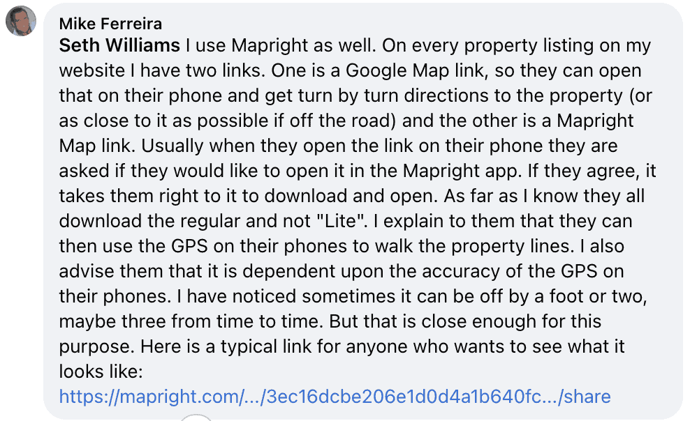
Here's how Mike Ferreira explained it,
“On every property listing on my website I have two links. One is a Google Map link, so they can open that on their phone and get turn by turn directions to the property (or as close to it as possible if off the road) and the other is a Mapright Map link. When they open the link on their phone, they will be asked if they would like to open it in the MapRight app. If they agree, it takes them right to the app store to download and open the app. I explain to them that they can then use the GPS on their phones to walk the property lines. I also advise them that it is dependent upon the accuracy of the GPS on their phones. I have noticed sometimes it can be off by a foot or two, maybe three from time to time. But that is close enough for this purpose. Here is a typical link for anyone who wants to see what it looks like: https://mapright.com/…/3ec16dcbe206e1d0d4a1b640fc…/share“
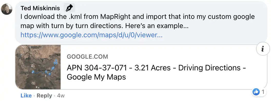
Ted Minkinnis goes a step further,
“I download the .kml from MapRight and import that into my custom google map with turn-by-turn directions. Here’s an example… https://www.google.com/maps/d/u/0/viewer…“
Want to learn how to create these maps on your own? This video will show you how it's done with Land id.
LandGlide, HuntStand or onX Hunt Apps
A few mobile apps on the market can also be used with the GPS functionality on most mobile phones to help potential buyers know when they are standing on a property.
With LandGlide, these parcel lines are used from a pre-existing database. With HuntStand or onX Hunt, these parcel lines can be drawn manually or used from an existing database.
If you're using any kind of mobile app, a few drawbacks can come into play.
- The buyer must go through the steps of downloading the app and creating an account.
- The property needs to be within range of a signal for the GPS to work properly.
- Except for Land id (which can be used for free by the end-user, provided the map creator has a paid account), most of these apps require signing up for a “free trial” or a paid subscription, which could be a deal-breaker for most one-time users. Even with a free trial, it's more “stuff” a user must endure to try using the app, and some people won't tolerate it.
A Series of Satellite Maps
I've done this for years because when I started in the land business, all these sophisticated mobile apps didn't exist.
This method is free and doesn't require anyone to download an app.
As I explain in this blog post, these parcel maps aren't difficult to get.
Using the interactive map from your county (or a service like DataTree, Google Earth with Parlay, or Land id), you can start with a closeup of the parcel (it helps to highlight the subject property to make it clear which parcel is yours) and take a series of sequential screenshots as you zoom out. This helps give a good perspective of the property's location relative to its surroundings.
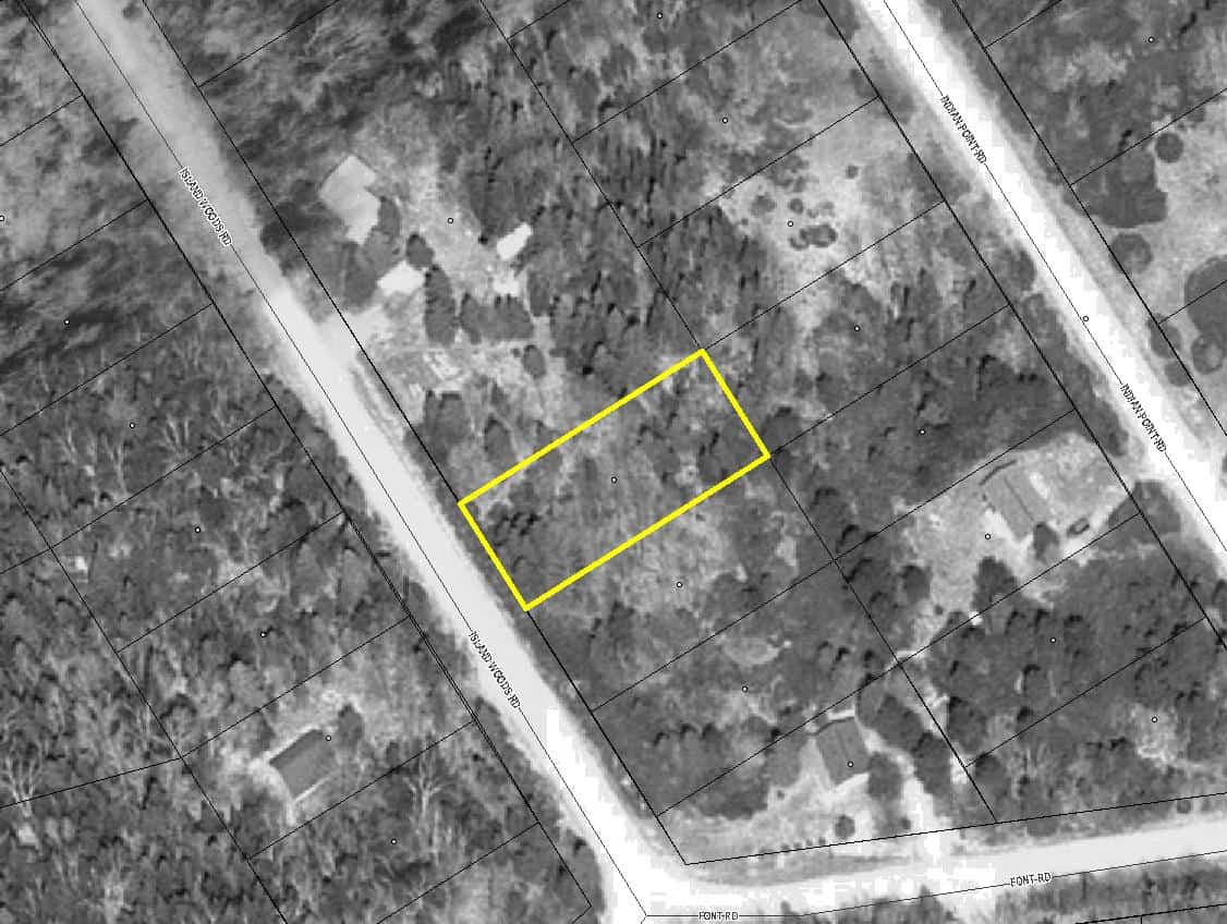
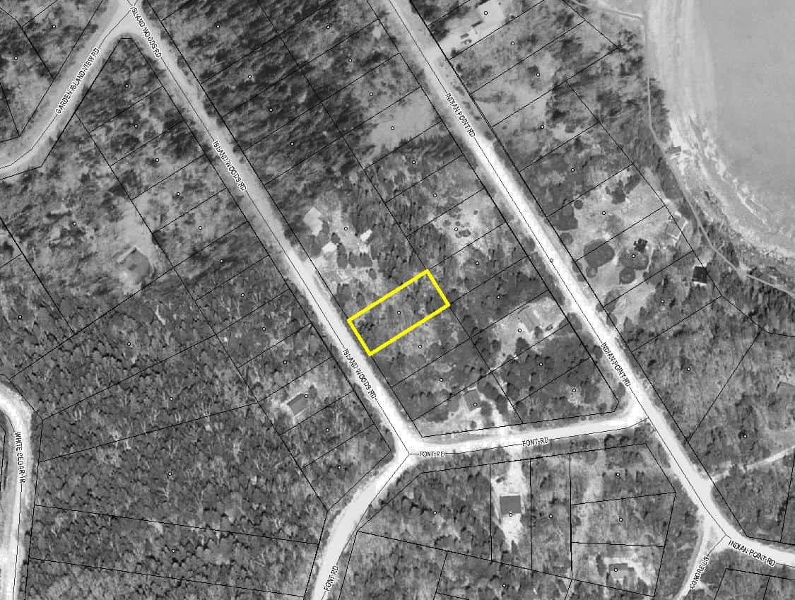
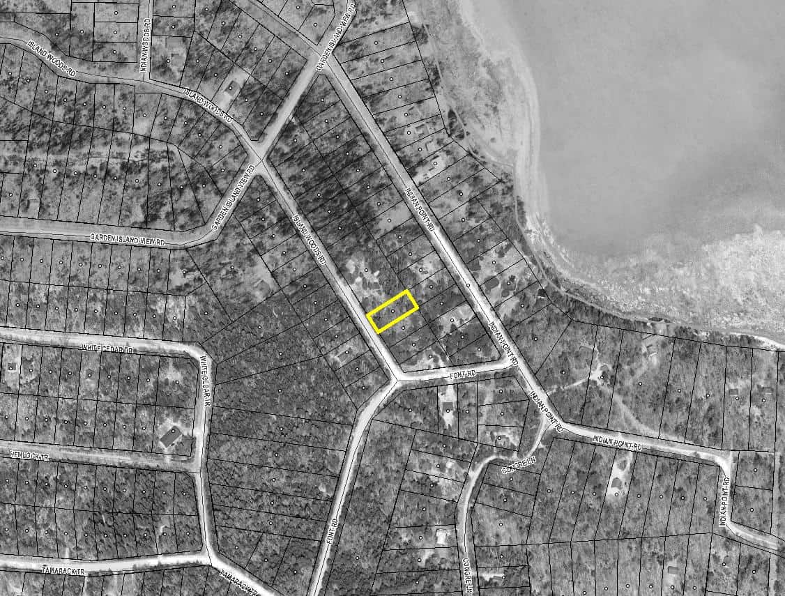
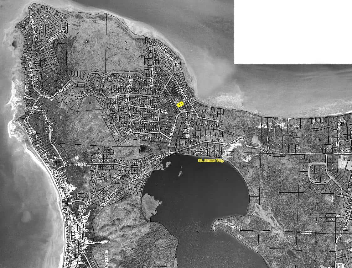
The only real downside of this approach is that it's not an interactive map. It still relies on the user to drive themselves to the near vicinity and understand where they're standing relative to the parcel lines (if they're standing in the wrong place, looking at the wrong thing, there won't be a mobile app there to correct them).
They will also need access to a printer or a mobile device to hold these images in their hand as they visit the property.
Even so, I've found at least 90% of people are competent enough to work with this without complaint or confusion. I rarely send these kinds of parcel maps to a potential buyer, and they aren't able to figure it out on-site.
Hire a Local Realtor
Another option is to find a local real estate agent who can step in and help you out.
As Mark Koster explains,
“If all else fails, have them get a realtor to walk the property with them. It's an expensive walk, but if you need it sold, may be worth it.”

In most cases, this person will have little familiarity with your property. The only real value they're bringing is their physical presence of someone who looks and sounds professional enough to stand in for you.
With this approach, you'll still need to go through the motions of making sure the potential buyer AND the realtor understand where the property is (just because a person has a “REALTOR” badge doesn't mean they'll be smart enough to find the property if you give them the parcel number).
You'll still have to make the process just as idiot-proof for both of them, but if this is the only issue standing in your way, it could check the box to get it sold.
If you've got a local real estate agent that you're regularly working on deals with, they may even be kind enough to do this for free… but in most cases, you should expect to compensate them in some way, either by paying them a percentage of the sale price when the property sells (6% – 10% is typical for vacant land properties) or just a flat fee for their time. Just ask them what their price is, and they'll tell you.
When Nothing Seems to Work
As you can see, there are plenty of ways to help a buyer find and view your property on-site.
Even so, there are some cases where nothing will be sufficient unless YOU meet them at the property.
For most of us, this isn't feasible because we live too far away, have too many other deals to worry about, or just don't want to spend our time this way.
Don't forget that you always have the option to say “no.”
I understand the desire to make everyone happy for the people-pleasers out there.
I also understand the desperation when a property takes forever to sell, but sometimes it just can't be done.
Don't forget that you are the boss of your own business and are allowed to fire the prospect at any time, especially when they start making demands that aren't in your best interests.
Do you have any tricks for helping people locate your vacant lots? Let us know about it in the forum!