REtipster features products and services we find useful. If you buy something through the links below, we may receive a referral fee, which helps support our work. Learn more.
Vacant Land is one of the most overlooked and misunderstood real estate investments in the world.
Most real estate investors completely fail to recognize the superior benefits of owning land in its raw form.
The simplicity and stability that come with owning the right piece of land, purchased at the right price, can far outweigh the myriad of problems that are certain to come up with any other type of real estate.
While I firmly believe that vacant land is one of the best places you can put your money, there is another side of the story that should be carefully considered.
As an experienced land investor, I've learned (sometimes the hard way) that several things need to be evaluated before purchasing a parcel of vacant land.
Land Can Be Deceptively Complicated
Vacant land may seem like a simple type of real estate, but there can be A LOT of potential problems lurking beneath any piece of land. I wouldn't necessarily say all these issues are common, but the fact is, any one of them could become a huge liability if you don't discover them before you buy.
Don't get me wrong, land is a rock-solid investment. It's just a matter of knowing what to watch out for in your due diligence process and under what circumstances you should re-adjust your offer price or walk from the deal altogether.
1. Zoning
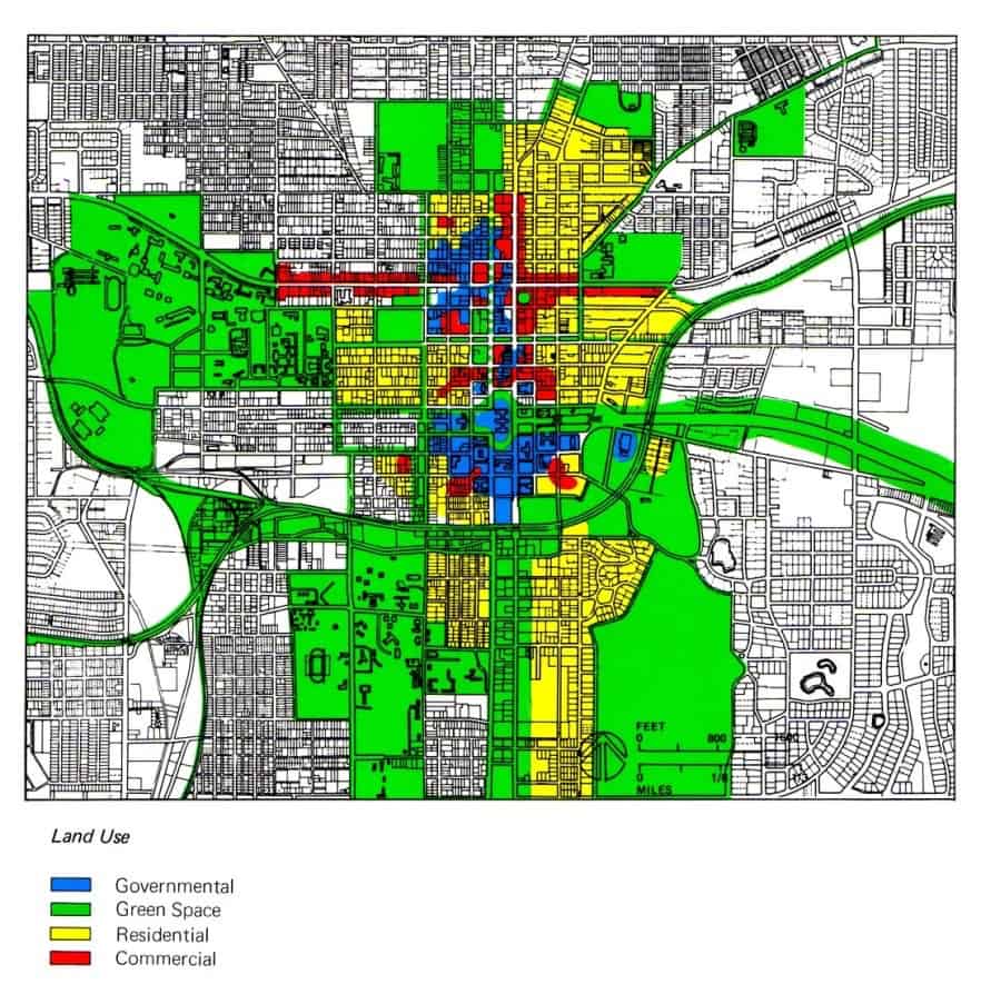
Once you know the zoning classification (e.g., residential, commercial, industrial, agricultural, etc.), ask them to give examples of what types of property uses would be allowed under this zoning type. They may even give you some ideas you hadn’t previously thought of.
Once you understand the most ideal use for the land you're looking at, you can quickly determine whether it will fit your needs (or the needs of those you intend to sell the property to in the future).
RELATED: 8 Land Investing Myths Debunked
How to Check Zoning?
Zoning is typically managed at the city or township level. To determine the zoning for a property, start by identifying the city, township, or municipality where the property is located. Then, search online for terms like ‘[City/Township Name] Zoning Map' or ‘[City/Township Name] Planning and Zoning Department.' This should lead you to a website with a zoning map or contact information for the zoning office. If the map isn’t available, you can call the office and ask about the zoning. Be sure to have the parcel number ready, as they’ll need it to look up the property.
Tip: Online services like Land ID or The Land Portal often provide general zoning information. While this can be helpful, it isn’t always precise. Zoning classifications usually include subcategories (e.g., Residential – R1, Residential – R2), so it's best to confirm the exact classification with the local zoning office.
Once you know the exact zoning classification, you have two options:
- Ask the Zoning Office: Contact the office directly to confirm what uses are allowed for your property under its zoning type.
- Search for the Zoning Ordinance: Look up ‘[City/Township Name] Zoning Ordinance' online. With some research, you can typically find detailed rules and restrictions for your property’s zoning classification.
By following these steps, you can ensure you have the most accurate and specific information about your property’s zoning.
2. Topography
When buying vacant land in an area with variable terrain (cliffs, mountains, valleys, ravines, etc.), my first line of business is to understand the property's topography.
A property's topography can greatly impact its build-ability, and if it is difficult to build on, it can have a huge negative impact on its value.
For this reason, it's important to do some preliminary research to look at the topographic contour lines that affect your property and the surrounding area.
How to Check Topography?
One of the easiest ways to check topography is with paid tools like The Land Portal, which can show these contour lines throughout the country.
If you're looking for a free way to do this, Google Earth and the topography maps from Earth Point can be useful, too. With Google Earth, you can search for your property (using the address or coordinates) and zoom in using your mouse buttons and the control/command and shift keys on your keyboard. This will allow you to tilt the earth to see where all the hills and valleys are in your area, along with the topo map overlay from Earth Point.
As you can see, this combination of software can give you a crucial perspective on what type of property you're considering. If you want even more clarity on your property's parcel lines, check out Parlay, which is another helpful resource.
RELATED: 10 Google Earth Hacks Every Real Estate Professional Should Know
3. Property Taxes
If you plan to hold onto a property for any length of time, it’s important to understand the approximate annual cost of property taxes.
For most vacant land, property taxes are relatively low, but this isn’t always the case. Be cautious of unusually high tax bills compared to the property’s value.
While it's not common, some properties have disproportionately high taxes—for example, if you have a $10,000 property with a $2,000 annual tax bill, this is excessive!
Based on experience, a reasonable annual tax bill typically falls between 1% and 4% of the property’s full market value.
Understanding this cost is crucial because it will remain your responsibility for as long as you own the property.
How to Check Property Taxes?
If you're using a data service like The Land Portal, you can usually find the annual property tax bill by clicking into each property to view it's ownership and characteristic details. These platforms provide a convenient starting point.
For a free option, you'll first have to determine which city or township the property is located in. Search online for ‘[City/Township Name] Property Taxes' to locate the municipal website where people can pay their property taxes. This is where you can often search for your property by parcel number or owner name to see what is currently owed, or what was paid over the past year.
Note: Property taxes are generally administered at the city or township level—not the county level. Counties typically step in only when property taxes go unpaid for an extended period. The city or township will have the most accurate and recent information about the tax bill.
If you cannot find the information online, you can call the city or township Treasurer (Tax Collector) directly. Once you find their website, call their office, provide the parcel number, and ask them to verify the property’s tax details.
4. Public Utilities
If a property doesn't have access to essential public utilities like water, sewer, electricity, gas, or phone service, it may not be an ideal candidate for construction.
Think about it: would you want to build a house where you can’t flush the toilet, access clean water, or power your appliances? While there are alternative solutions—like septic systems, well water, solar energy, or propane tanks—these can add significant costs and complexity to your plans. If such obstacles exist, it’s crucial to identify them before purchasing the property.
Granted, some alternatives can be sought if the owner is willing to pay the price (septic systems, well water, solar energy, propane tanks, etc.), but if these obstacles exist, you'll want to know about them before you buy.
Just like topography issues, the absence of utilities can greatly diminish a property’s value, particularly if the highest and best use is for building. Since most buyers purchase land with the intent of construction, any utility limitations could severely impact the property’s desirability.
How to Check Utilities?
Start by identifying the local utility providers for services like water, sewer, electricity, gas, phone, and internet. You can get this information from the local municipality or county office.
Once you know the providers, reach out to them with the property address or parcel number to confirm whether their services are available at the location. Keep in mind, many city or township zoning and planning offices maintain utility maps or records that can help clarify which utilities are accessible. You can search online for “[City/Township Name] Planning and Zoning Department” or call them directly for more information.
When visiting the property, look for visual signs of utility access, such as power poles, water meters, or gas line markers. However, keep in mind that proximity to utilities doesn’t always guarantee easy or inexpensive connections, so it’s worth verifying potential costs.
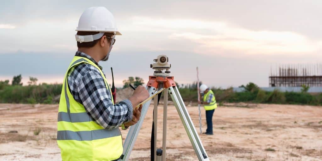
If you’re dealing with a larger or rural property, hiring a land surveyor or civil engineer can be a smart move to confirm utility availability and assess connection feasibility.
Lastly, some property data services like The Land Portal or Land ID can provide basic utility information, but it’s always a good idea to validate these details with utility companies or local government offices to ensure accuracy.
5. Building Setback Requirements
Building setback requirements are very common and are imposed as a way of giving order and consistency to the buildings in any given area.
When you consider these setbacks and regulations (relative to the parcel size), ask yourself,
Is there still enough room to build something worthwhile here, or is this property useless?
Can I still build in the most idea area, or will the setbacks get in the way?
I've come across several properties that were too small to build anything on because of the size of the property in relation to its required setbacks. Again, if a property isn't buildable or has severely limited uses, it will lose a big portion of its value.
How to Check Building Setbacks?
Once you understand the dimensions of the parcel you're evaluating, call the local planning department, give them the parcel number of your property and ask them what the designated building setbacks are for the property.
6. HOA and Other Usage Restrictions
Most of the vacant land you'll encounter will have SOME kind of usage restrictions in place (there's a reason you'll never see a 100-acre pig farm next to a 100-story skyscraper or a massive shopping mall next to a landfill… it just doesn't make sense).
Every municipality in America has a plan (even if it's a vague one) for how they want different sections of their land to be used, regardless of who owns it. As such, you should always expect your property to come with some reasonable limitations on what it can be used for.
If the property is part of a Home Owner's Association (HOA), it will most likely have even more restrictions in place to help maintain the “quality” and formality of the neighborhood. The idea is to keep any bizarre behavior OUT of the neighborhood (e.g. – cars in the front yard, lawns nobody takes care of, houses that look out of place, etc).
Usage restrictions aren't necessarily bad; they usually exist for a reason and make sense on some level. They're designed to help maintain order and support the value of each property in the subdivision. On the same coin… if you aren't aware of these restrictions before you purchase, they can also create some conflict with the plans you had in mind for the property.
This isn't common for most land investors (because most people have no intention of using their property for purposes that don't jive with their surroundings). Even so, you should always understand the rules before buying a parcel of vacant land. This will help you avoid owning a property that requires maintenance you don't want to do or that can't be used for your intended purpose.
How to Check for HOAs and Restrictions?
If the property isn’t publicly listed and there’s no realtor involved, start by requesting recorded documents from the county recorder’s office, as these often include references to a Homeowner’s Association (HOA) or covenants, conditions, and restrictions (CC&Rs).
RELATED: How to Do Your Own Title Search
You can also search online for the subdivision name or nearby addresses to see if an HOA governs the area, as many HOAs have websites or public records. If these steps don’t give you a clear answer, you could also try contacting neighbors or the local zoning/planning office, as they often have information about HOA regulations in the area.
If the property is part of an HOA, request a copy of the Covenants, Conditions, and Restrictions (CC&Rs), which outline the specific rules for the neighborhood. This document is usually available from the HOA or the title company during due diligence. If you cannot locate the CC&Rs, call the HOA or the property management company directly to ask for clarification.
7. Flood Zone
In some parts of the country, parcels of land are vacant because they are literally underwater. In other areas, properties near bodies of water may be at high risk of flooding.
In either case, if a property is located in a flood zone – you'll want to know about this BEFORE you buy because when a property is in a flood zone, it can be extremely expensive to insure.
Land located near a body of water can be extremely valuable, but this proximity can also create several potential issues, so be sure you understand the ramifications of your particular location.
How to Check for Flood Zones?
With data services like The Land Portal, Land ID, or DataTree, it's easy to check for flood zones affecting your property.
If you're looking for a FREE way to check if your property is in a flood zone, visit FEMA.gov and/or use the NFHL Viewer.
8. Perc Test or Sewer System
If you're planning to build a dwelling of any kind on your parcel of land, there is one issue that may seem insignificant at first glance, but it has the potential to make or break a land deal. It's called a “Perc Test,” and if you're dropping some serious coin on land in a rural area, this is an issue you'll want to be sure about before you sink your money into it.
A Perc Test (also known as the “Perk Test” and more formally known as a “Percolation Test“) is a soil evaluation that tests the rate at which water drains through the soil. If a property doesn't have easy access to the local sewer system, a perc test is required to determine whether a septic system (the alternative to a sewer) can be installed on the property.
If a property doesn't pass this test, you could have a very difficult time building any type of dwelling on the property, so unless you're able to tap into the municipal sewer system (which will negate this issue altogether), be sure to give the county health department a call and ask them what is required to install a septic system (or connect to the local sewer) in your area.
How to Do a Perc Test?
The proper way to do a perc test is to contact your county Health Department and ask them how to proceed. In some counties, the Health Department will administer the perc test themselves. In other counties, they will refer you to an independent contractor who will do the work and give you their findings.
Unfortunately, doing a perc test the prop way costs money and takes some time. If you're putting tens of thousands into a property, it's worth the time and money to do this right, because a property that doesn't perc could blow up your deal (and not in a good way).
Keep in mind, soil percolation isn't a big problem in all areas. If your property is located in a sandy desert, you probably don't need to lose sleep about whether your property will pass this test.
If you're dealing with a very cheap property that doesn't justify the cost of a perc test (e.g. – if the perc test costs more than the property itself), you could do a lower-quality (but better-than-nothing) “desktop perc test” from your computer.
To do this, start by examining nearby properties to see if they have houses with septic systems. This isn't a guarantee that your property will perc, but if the neighbors did, this is at least a clue that yours might.
You can also use tools like the NRCS Web Soil Survey to analyze the soil type, looking for sandy or well-draining soils, and check topographic maps to identify elevation changes that could impact drainage (again, if you want an easier-to-use paid software that can do this, try The Land Portal or Land id). You can also ask to review county records for past perc tests in the area and contact the local health department to understand their septic system requirements.
While these exercises aren't a substitute for an official test, these steps can provide valuable insights into a property’s likelihood of passing a perc test.
9. Road Access
Believe it or not, there are thousands of properties all over the country that are landlocked with no road access.
They are surrounded by other, privately owned properties, and since there is no way to access these property without trespassing over someone else's land, these landlocked parcels are legally inaccessible. They might as well be on another planet, because nobody can legally get to them!
This issue can be overcome if you can obtain a legal easement to the property from one of the surrounding neighbors, so you can travel through their property to your own. In some cases, there are legal mechanisms that can force an easement through a neighboring property (at a cost, of course). However, in other states, you'll only be able to get an easement if the neighbors decide to cooperate.
Keep in mind, landlocked properties aren't always a deal-breaker. Sometimes, they can be a great opportunity if you're able to resolve the easement issue, or if one of the neighboring owners wants to buy it from you. In fact, one of the highest ROI deals I've ever done was a landlocked property!
Also, remember that some properties may not have road access but physical access through a common area or government-owned land. Even without the convenience of a road, the ability to access your land without trespassing over someone else's property will offer an important benefit.
For obvious reasons, a property with any physical access is preferable to a completely inaccessible property.
Either way, if your property is landlocked, you'll want to know this early on so you can adjust your offer WAY down to account for the limited usability (or walk away from the deal altogether).
How to Check for Road Access?
Find your property on Google Earth (or whichever paid data service you use) and look for which roads are touching your property.
10. Physical Access
Some properties may not have road access but physical access through a common area or government-owned land.
Even without the convenience of a road, accessing your land without trespassing over someone else's property will offer an important benefit.
For obvious reasons, a property with any physical access is preferable to a completely inaccessible property.
How to Check for Physical Access?
If no roads lead to your property, examine the GIS parcel lines and satellite maps can often identify physical access. Simple foot trails or ATV paths to and from a property from a public road can be a good indication of established physical access that has been used consistently for a length of time.
11. Size, Shape, Dimensions, and Location
I've seen several properties that are virtually useless due to their size and shape. On one occasion, I came across a parcel of land 5 feet wide and 900 feet long. I've also seen properties that were 10 feet by 10 feet.
Use your common sense if you see a parcel of land with an odd shape. You'll probably want to pass on it if you can't think of any legitimate uses for a property with its given dimensions.
How to Check the Size, Shape, Dimensions and Location?
You can find the size, shape, location, and dimensions quickly if your county has a free GIS mapping system online.
You can also use a service like Parlay or Land id (both of which require a paid subscription) and Google Earth (free) to find a parcel map of your property. Here's how it works:
Of course, none of these GIS mapping systems are perfect. The only way to be 100% certain about the size and shape of a property is to order a land survey. Still, these online mapping solutions can be very useful if you're looking for a faster, cheaper way to get a basic idea that is usually reliable.
12. Water Access
Many properties don’t have access to a municipal water supply (i.e., city water). This isn't necessarily a problem, but it does mean someone will have to drill a well to access a clean water source beneath the surface. There are a few ways to determine whether or not you'll be able to do this, but in most cases, if there are other buildings in the near vicinity (e.g., homes or other dwellings built next door), this is usually a good indication that you won’t have any problems accessing water either.
If you’re looking at a vacant lot in the middle of the desert or near the top of a mountain with nothing around for miles, you will probably want to verify that water will be acessible if/when you need it. If your only option is to have it hauled in by truck, you'll want to know how much this will cost on an ongoing basis.


